Road & Infrastructure Digital Solutions
Transform infrastructure construction and management with our comprehensive Digital PMC solutions. Monitor real-time construction progress with Observance Eye, create precise digital twins using LITHIC Pro scanning, and ensure quality through dimensional verification and thermal analysis for roads, bridges, tunnels, and superstructures.
Comprehensive Road & Infrastructure Management
Real-time Construction Progress Monitoring
Track road construction progress in real-time using Observance Eye with 360° site capture, comparing planned vs actual progress to ensure project timelines are met.
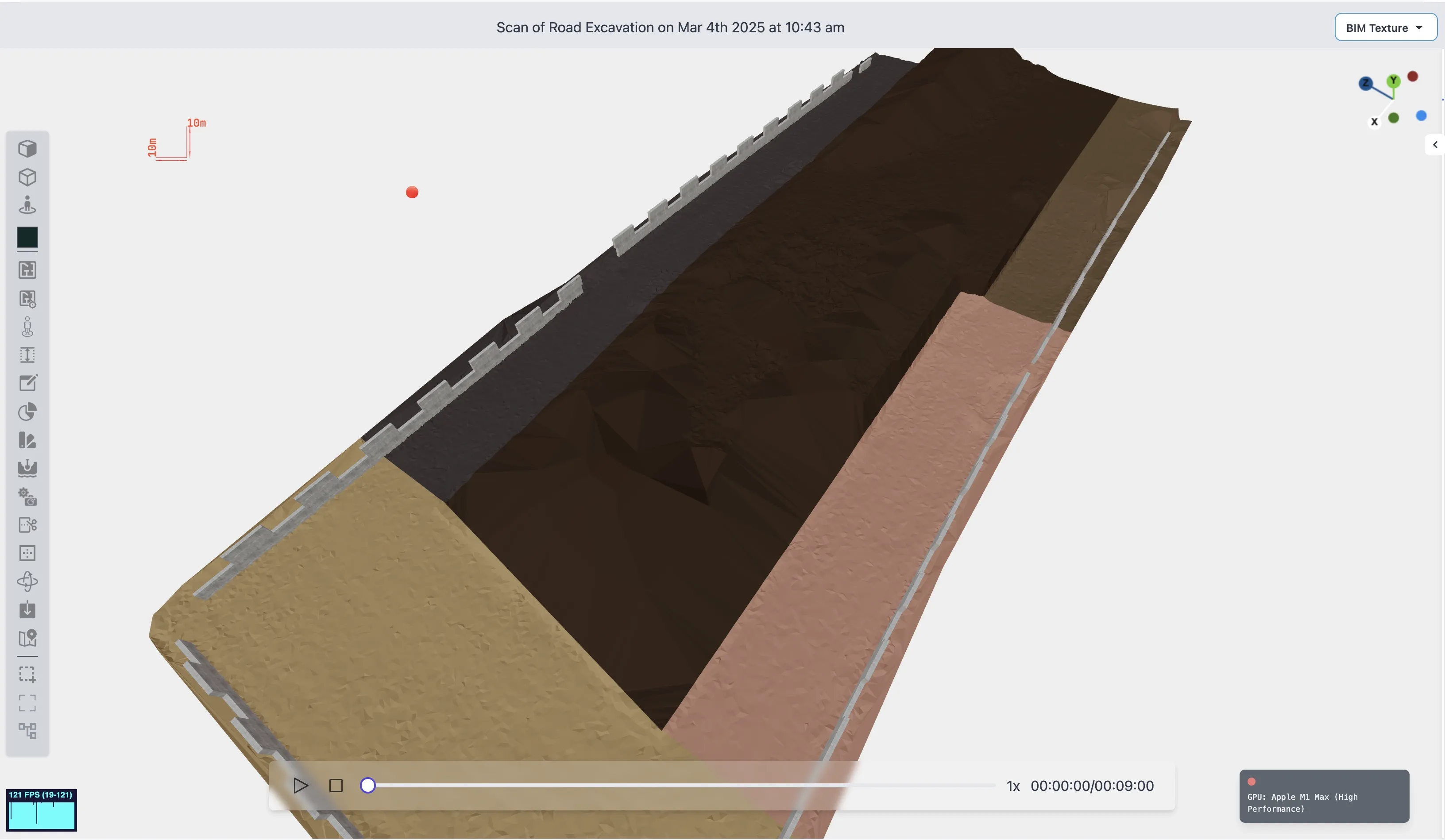
Digital Replica of Road Assets
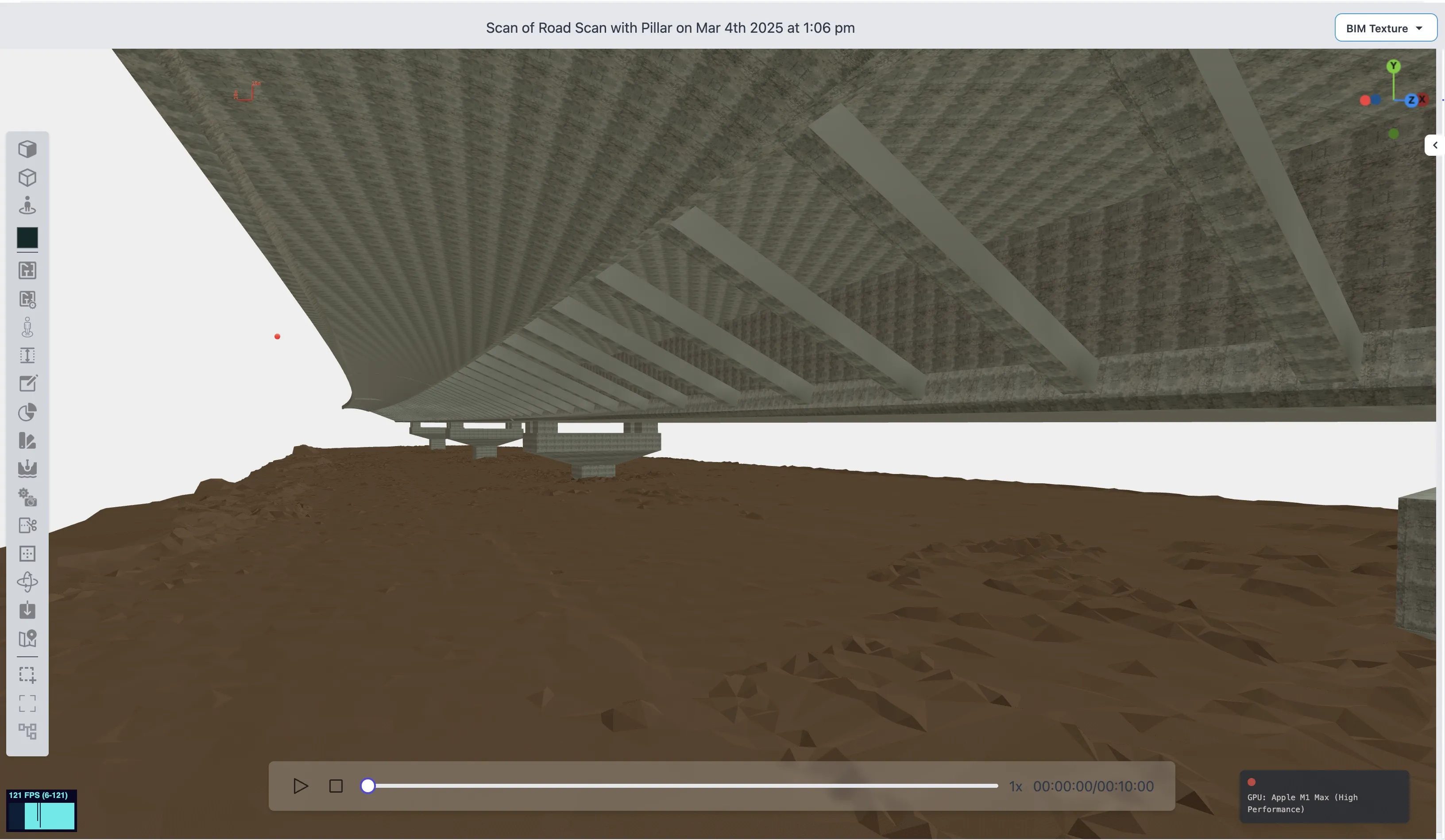
Create comprehensive digital twins of road infrastructure including bridges, tunnels, and superstructures with detailed asset information and condition assessment.
Dimensional Quality Verification
Automated digital verification of road dimensions including width, length, pavement markings, and elevation to ensure compliance with engineering specifications.
Pothole & Defect Detection
AI-powered detection and classification of potholes, cracks, and surface defects with precise location mapping for maintenance prioritization.
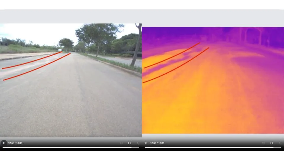
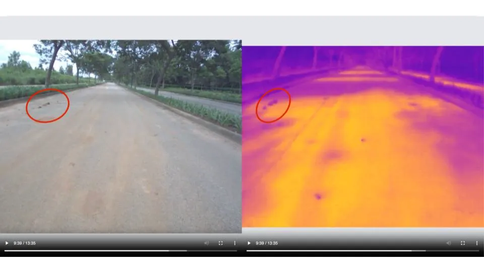
Thermal Quality Assessment
Thermal profiling of cement surfaces to detect undulations, potential cracks, and quality issues in finished construction works before they become visible problems.
Pre & Post Construction Documentation
Comprehensive surveying of open land and existing infrastructure using drones with LITHIC Pro for feasibility reports and as-built documentation.
Comprehensive Infrastructure Documentation & Monitoring
360° Site Capture
Real-time construction progress monitoring and virtual site visits with comprehensive 360-degree documentation using Observance Eye platform.
Thermal Profiling of Cement
Advanced thermal analysis to detect temperature variations in cement surfaces, identifying potential undulations, cracks, and quality issues before they become visible.
Dimensional Quality Check
Automated verification of road dimensions including width, length, elevation profiles, and pavement markings against engineering specifications with ±5mm precision.
Open Land & Infra Survey
Comprehensive drone-based surveying of open land and existing infrastructure using LITHIC Pro for feasibility studies, environmental assessments, and project planning.
Cracks & Bulges Detection
AI-powered identification and classification of surface cracks, bulges, and structural deformations with precise location mapping and severity assessment.
Multi-Infrastructure Coverage
Specialized scanning and documentation approaches for roads, bridges, tunnels, and complex superstructures with tailored methodologies for each infrastructure type.
Real-time Progress Monitoring with Observance Eye
Monitor construction progress continuously with 360° site capture, virtual inspections, and automated progress reports for stakeholders.
Comprehensive BIM Outputs for Infrastructure Projects
Detailed 3D models, precision 2D drawings, and digital asset inventories delivered in industry-standard formats for seamless integration with your existing workflows.
3D Infrastructure Models
Comprehensive 3D models of roads, bridges, tunnels, and superstructures with detailed geometry, material properties, and asset information.
Available Formats:
Includes:
- Complete road geometry with centerlines and cross-sections
- Bridge and tunnel structural elements
- Guardrails, signage, and safety features
- Elevation profiles and grade information
- Material specifications and properties
Precision 2D Technical Drawings
Detailed CAD drawings including plan views, elevation profiles, cross-sections, and construction details with automatic dimensioning.
Available Formats:
Includes:
- Plan and profile drawings with annotations
- Cross-sectional views at specified intervals
- Detail drawings of intersections and structures
- Dimensional annotations and specifications
- Layer organization for different asset types
Digital Asset Inventory
Complete digital catalog of all infrastructure assets with condition assessments, maintenance records, and lifecycle information.
Available Formats:
Includes:
- Asset identification and classification
- Condition ratings and defect mapping
- Maintenance history and recommendations
- Geographic coordinates and positioning
- Photos and thermal imagery attachments
Monitor Your Infrastructure Progress in Real-time
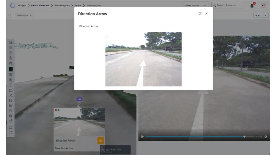
360° Site Walkthroughs
Take virtual tours of your construction site with real-time 360° walkthroughs for complete transparency.
Side-by-Side Comparisons
Compare past vs current site conditions with precision to monitor progress and identify changes over time.
Remote Monitoring
Monitor your projects from anywhere with mobile and desktop access for multi-project management.
Annotation & Task Management
Spot, tag, and solve issues instantly with precise localization and seamless task assignment capabilities.
Comprehensive Digital Replica & Asset Documentation
Our advanced scanning and documentation capabilities create comprehensive digital replicas of your road and infrastructure assets. From individual elements to complete systems, we capture precise geometric data, material properties, and condition information to support lifecycle management and maintenance planning.
Digital Asset Types
Road Surface & Pavement
Complete 3D documentation of road surfaces including pavement markings, texture, and dimensional specifications with elevation profiles.
Bridges & Overpasses
Detailed digital twins of bridge structures including deck, supports, railings, and all structural elements with precise geometric data.
Tunnels & Underground Infrastructure
Comprehensive scanning and modeling of tunnel interiors, portals, ventilation systems, and safety infrastructure elements.
Superstructures & Support Systems
Digital documentation of retaining walls, culverts, drainage systems, and other critical infrastructure support elements.
Traffic Control & Safety Assets
Precise positioning and condition assessment of signage, guardrails, barriers, and traffic control devices with dimensional verification.
Utilities & Service Infrastructure
Documentation of utility lines, service access points, lighting systems, and other infrastructure utilities within the project scope.
Common Questions About Our Infrastructure Solutions
Find answers to the most frequently asked questions about our road and infrastructure Digital PMC solutions
Ready to Transform Your Infrastructure Project?
Experience the power of Digital PMC with real-time monitoring, precise documentation, and comprehensive BIM deliverables for your road and infrastructure projects.